

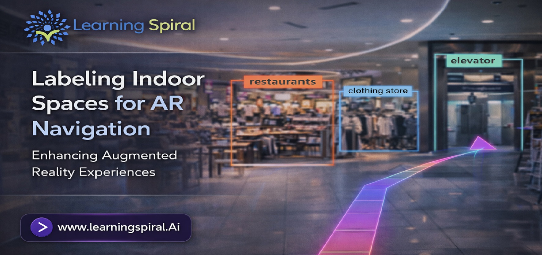
Imagine entering a large airport, hospital, shopping mall or university campus and simply raising your smartphone to see arrows guiding you directly to your destination.
No confusing floor maps. No repeated searches for signboards. No uncertainty about which corridor or staircase to take.
This is one of the most practical applications of AR-powered indoor navigation.
But for an AR navigation system to guide a person accurately, it first needs to understand the physical environment around them. It must recognise floors, walls, doors, corridors, elevators, stairs, signs, landmarks, obstacles and navigable pathways—and understand how these elements relate to one another spatially.
That understanding does not come automatically from raw camera footage or 3D scans.
It starts with high-quality data annotation.
Accurately labeled indoor datasets provide the structured training information computer vision and spatial AI systems need to interpret complex indoor environments and deliver more dependable navigation experiences.
What Is Indoor Space Labeling for AR Navigation?
Indoor space labeling is the process of identifying, classifying and marking important physical and spatial elements within images, videos, depth maps or 3D scans captured inside buildings.
The labels can represent structural elements such as walls and floors, navigation points such as doors and elevators, permanent landmarks such as reception desks or signs, and temporary obstacles such as furniture or equipment.
These annotated datasets can then be used to train computer vision models to recognise similar elements in real-world environments.
augmented reality combines digital information with a user’s view of the physical environment. For navigation applications, this may allow directional arrows, destination markers, contextual information or route guidance to appear relative to real objects and spaces.
Meanwhile, an indoor positioning system helps determine the position of people or objects inside buildings, where satellite-based positioning may be less effective.
When computer vision, spatial mapping, positioning technologies and accurately annotated datasets work together, AR navigation becomes much more practical.
Why Does AR Navigation Need Labeled Data?
A human entering a building can immediately understand that a doorway leads into another room, a staircase connects floors and a temporary trolley in a corridor should be avoided.
An AI model initially sees something very different: pixels, frames, depth values or millions of 3D coordinates.
Annotation provides meaning to that raw information.
Through image labeling, walls can be classified as walls, doors as doors, exits as exits and obstacles as obstacles. Through depth and point-cloud labeling, spatial relationships can also be represented more precisely.
This transformation from raw environmental data into structured training data is what allows AI models to learn how indoor environments are organised.
For teams building visual perception systems, professional Image Annotation can therefore become an important component of the AR development pipeline.
What Should Be Labeled Inside an Indoor Environment?
The annotation taxonomy will depend on the application, but an indoor navigation dataset may contain several categories of objects and structural elements.
1. Structural Elements
Walls, floors, ceilings, pillars, doors, windows, staircases, escalators and elevators help an AI system understand the overall geometry and accessibility of a building.
Precise segmentation of these elements can help distinguish navigable areas from restricted or non-navigable surfaces.
2. Navigation Landmarks
Room numbers, directional signs, exit boards, reception desks, gates, counters, information boards and permanent visual landmarks can become useful reference points for localisation.
For example, recognising a specific reception desk or directional board may help an AR application determine where the user is standing relative to the mapped environment.
3. Navigable Paths
Corridors, walkways, entrances, intersections and accessible routes need to be identified carefully.
Semantic segmentation can be particularly useful here because it allows an annotation team to classify complete regions of an image rather than only individual objects.
4. Obstacles
Chairs, tables, equipment, boxes, barriers, temporary displays and other objects may affect a user’s movement.
Training datasets containing diverse obstacle examples can help perception models distinguish between clear pathways and blocked areas.
5. Points of Interest
Stores, departments, hospital wards, classrooms, meeting rooms, restrooms, emergency exits and service desks may be assigned labels depending on the intended AR navigation experience.
Annotation Techniques Used for Indoor AR Data
No single annotation method is suitable for every indoor navigation project. The right approach depends on the sensor setup, model architecture and level of spatial detail required.
Bounding Box Annotation
Bounding box annotation can identify distinct objects such as doors, signs, displays, chairs, equipment and other indoor objects.
It is useful when the primary objective is object detection rather than highly precise boundary understanding.
Polygon Annotation
Indoor objects rarely follow perfect rectangular boundaries.
Polygon annotation allows annotators to trace irregular objects and architectural structures more precisely, making it useful for doors, furniture, counters, equipment and structural features.
Semantic Segmentation
Semantic segmentation assigns a class to pixels within an image.
For indoor navigation, an image could be segmented into classes such as floor, wall, ceiling, door, furniture, person, obstacle and navigable path.
This helps AI models develop more detailed scene understanding.
Instance Segmentation
When multiple objects from the same category appear in a scene, instance segmentation separates them individually.
For example, instead of simply identifying every chair as part of a single “chair” region, the model can learn to recognise each chair separately.
Keypoint and Landmark Annotation
Visual landmarks can support localisation and spatial alignment.
Important points on doors, signs, equipment, furniture or architectural structures may be annotated to help models recognise their position and orientation.
Video Annotation
Indoor navigation datasets may also include walking sequences captured through smartphones, wearable cameras or other devices.
Video Annotation can maintain consistent object identities across frames and provide valuable information about movement through an indoor space.
The result is a dataset that teaches AI not only what an object looks like, but also how the surrounding environment changes as a person moves through it.
Why LiDAR and 3D Point Clouds Matter for Indoor Navigation
Images provide rich visual information, but AR navigation frequently needs another dimension: depth.
This is where LiDAR, depth sensors and 3D spatial data become valuable.
A point cloud can represent the shape and geometry of an indoor environment using large collections of three-dimensional points. Walls, floors, doors, furniture and other structures can be represented according to their physical positions in space.
Through professional Lidar Annotation, raw spatial information can be transformed into structured labels that help AI systems identify objects, boundaries, distances and environmental geometry.
More detailed 3D point cloud annotation can further support applications requiring accurate spatial perception, including indoor robots, warehouse navigation, digital twins and augmented reality systems.
This combination of 2D visual data and 3D spatial data can give AI models a much richer understanding of an indoor scene.
A Typical Indoor Space Annotation Workflow
Creating reliable training data requires more than simply drawing labels around objects.
A structured annotation workflow can include:
1. Define the Navigation Objective: The team determines whether the system needs object recognition, pathway detection, localisation, obstacle avoidance, semantic mapping or a combination of these capabilities.
2. Develop the Annotation Taxonomy: Every required class—such as wall, floor, door, staircase, elevator, sign and obstacle—is clearly defined before large-scale annotation begins.
3. Annotate 2D Visual Data: Images and video frames are labeled using bounding boxes, polygons, semantic segmentation, instance segmentation or keypoints depending on project requirements.
4. Annotate Spatial Data: LiDAR scans, depth maps and point clouds are labeled to provide information about geometry, distance and object position.
5. Maintain Sequence Consistency: For video and sequential sensor data, labels should remain consistent as the camera or user moves through different areas.
6. Apply Quality Control: Reviewers verify class accuracy, object boundaries, missed annotations and consistency against project guidelines.
A strong Human in the Loop (HITL) workflow is particularly valuable here because indoor environments can contain ambiguity that automated pre-labeling systems may struggle to interpret consistently.
The Biggest Annotation Challenges in Indoor Spaces
Indoor environments can appear controlled, but they are surprisingly complex from a computer vision perspective.
One major challenge is repetition.
Hospital corridors, hotel floors, office buildings and warehouses may contain several areas that look almost identical. Similar doors, walls and lighting conditions can make localisation difficult unless datasets include reliable landmarks and spatial context.
Occlusion creates another problem. People, furniture or temporary equipment can partially hide doors, signs and other important navigation features.
Lighting can also change dramatically between locations or throughout the day. Glass surfaces, mirrors, shadows and reflections can further complicate image interpretation.
Multi-floor buildings introduce additional complexity because navigation systems must understand elevators, stairs, floor transitions and connections between spaces.
This is why high-quality Data Annotation Services need clear annotation guidelines, edge-case handling and robust quality assurance rather than basic object labeling alone.
Where Can Indoor AR Navigation Be Used?
AR-based indoor navigation can potentially support many real-world environments.
In airports, users can be guided towards gates, baggage counters, lounges or exits.
In hospitals, navigation can help visitors locate departments, diagnostic rooms, pharmacies and patient areas across complex building layouts.
In shopping malls, AR interfaces can guide customers towards stores, restaurants, parking areas and facilities.
On university campuses, navigation can help students and visitors find classrooms, laboratories, departments and event venues.
In warehouses and factories, similar spatial AI systems can support workers, autonomous robots and operational workflows by helping machines understand aisles, storage zones, equipment and restricted areas.
Museums, hotels, corporate campuses, railway stations and convention centres can benefit from similar technologies.
Why Annotation Quality Directly Affects Navigation Quality
Poor annotation creates poor ground truth.
If a doorway is incorrectly classified, an obstacle is missed or floor boundaries are inconsistent, the trained model can inherit those inaccuracies.
For navigation systems operating in physical environments, small labeling inconsistencies can become meaningful model errors.
High-quality data labeling therefore requires consistent class definitions, detailed guidelines, trained annotators and systematic review.
A reliable Dataset for Machine Learning should also represent the diversity that the deployed system is likely to encounter – including different lighting conditions, viewpoints, building layouts, crowd levels, object arrangements and sensor characteristics.
Dataset diversity is particularly important for AR navigation because the same type of building element can look dramatically different from one environment to another.
Choosing a Data Annotation Partner for AR Navigation Projects
AR and spatial AI projects often require more than conventional image classification.
A capable Data Annotation Company should be able to work across images, videos, LiDAR, depth information and 3D datasets while maintaining consistent annotation guidelines across modalities.
When organisations compare Computer Vision Companies in India, Data Labeling Companies in India or Image Annotation Companies in India, they should look beyond annotation volume alone.
Important considerations include the ability to understand complex class taxonomies, manage edge cases, support iterative guideline changes, perform multi-level quality checks and scale annotation projects without losing consistency.
Project-specific workflows are particularly valuable when annotation requirements evolve during model development.
How Learning Spiral AI Supports Spatial and Computer Vision Projects
Learning Spiral AI supports organisations developing computer vision and machine learning systems through scalable Data Labeling Services covering multiple forms of visual and spatial data.
Our capabilities include image annotation, video annotation, Lidar Annotation, 3D point cloud annotation, bounding box annotation, segmentation, image labeling and data labeling for AI and machine learning applications.
For teams developing AR, robotics, autonomous systems and other Physical AI applications, our annotation workflows can be adapted around project-specific objects, environments, sensor formats and labeling guidelines.
As an Annotation company for AI, our focus is not simply generating labels. It is creating consistent, model-ready datasets that help AI systems understand real-world environments more effectively.
Whether an organisation requires a pilot annotation project or larger data annotation projects, Learning Spiral AI can support structured workflows designed around accuracy, scalability and quality control.
From Indoor Maps to Spatial Intelligence
The future of AR navigation depends on more than displaying arrows over a camera feed.
The underlying AI must understand where the user is, what surrounds them, which routes are accessible, what objects matter and how the physical environment changes as they move.
High-quality AI Training Data Services provide the foundation for developing that understanding.
By combining image annotation, video annotation, LiDAR annotation, depth data and 3D spatial labeling, developers can transform ordinary indoor spaces into machine-readable environments.
And as AR, robotics and Physical AI become increasingly connected, the same accurately annotated spatial datasets may support far more than navigation—from intelligent robots and digital twins to contextual assistance and automated facility operations.
For organisations building the next generation of spatial AI, reliable annotation is not simply a preprocessing step.
It is part of the intelligence that helps machines understand the physical world.
Build Better AR and Spatial AI Datasets with Learning Spiral AI
Need accurately annotated image, video, LiDAR or 3D data for your computer vision project?
Learning Spiral AI provides scalable data labeling & annotation services for AI companies, computer vision teams, robotics developers and organisations building data-intensive machine learning applications.
FAQs
What is indoor space annotation?
Indoor space annotation is the process of labeling structural elements, objects, landmarks, pathways and spatial information in indoor images, videos, depth data or 3D scans so that computer vision models can learn to understand indoor environments.
Why is data annotation important for AR navigation?
Data annotation gives meaning to raw visual and spatial information. It helps AI models recognise doors, floors, walls, signs, obstacles, pathways and other elements required for localisation and route understanding.
Which annotation methods are useful for indoor navigation?
Common techniques include bounding box annotation, polygon annotation, semantic segmentation, instance segmentation, keypoint annotation, video annotation, LiDAR annotation and 3D point cloud annotation.
Can LiDAR annotation be used for indoor AR applications?
Yes. LiDAR and other depth-sensing technologies can provide detailed spatial information about indoor environments. Annotating these datasets helps AI understand depth, geometry, object locations and spatial relationships.
What industries can use AR indoor navigation?
Potential applications include airports, hospitals, shopping malls, warehouses, manufacturing facilities, universities, hotels, museums, railway stations and large corporate campuses.
