

Imagine an autonomous vehicle approaching a busy intersection. A delivery van is turning ahead, a cyclist is passing on the left, and a pedestrian is stepping toward the road.
Recognizing these objects is important. But recognizing them alone is not enough.
The vehicle’s AI must also understand where each object is located, how much space it occupies, and which direction it is facing. A small mistake in estimating an object’s dimensions or orientation can affect how a perception system interprets its surroundings.
This is where 3D Cuboid Annotation becomes essential.
By converting raw spatial sensor data into structured, labeled three-dimensional objects, cuboid annotation helps AI models learn real-world geometry and spatial relationships.
At Learning Spiral AI, we support businesses developing autonomous systems, robotics applications, and computer vision technologies with precise, scalable data annotation and labeling workflows.
In this guide, we explore how 3D cuboid annotation works, how annotators label object dimensions, positions, and orientations, and why reliable training data is fundamental to the development of Spatial AI.
What Is 3D Cuboid Annotation in Spatial AI?
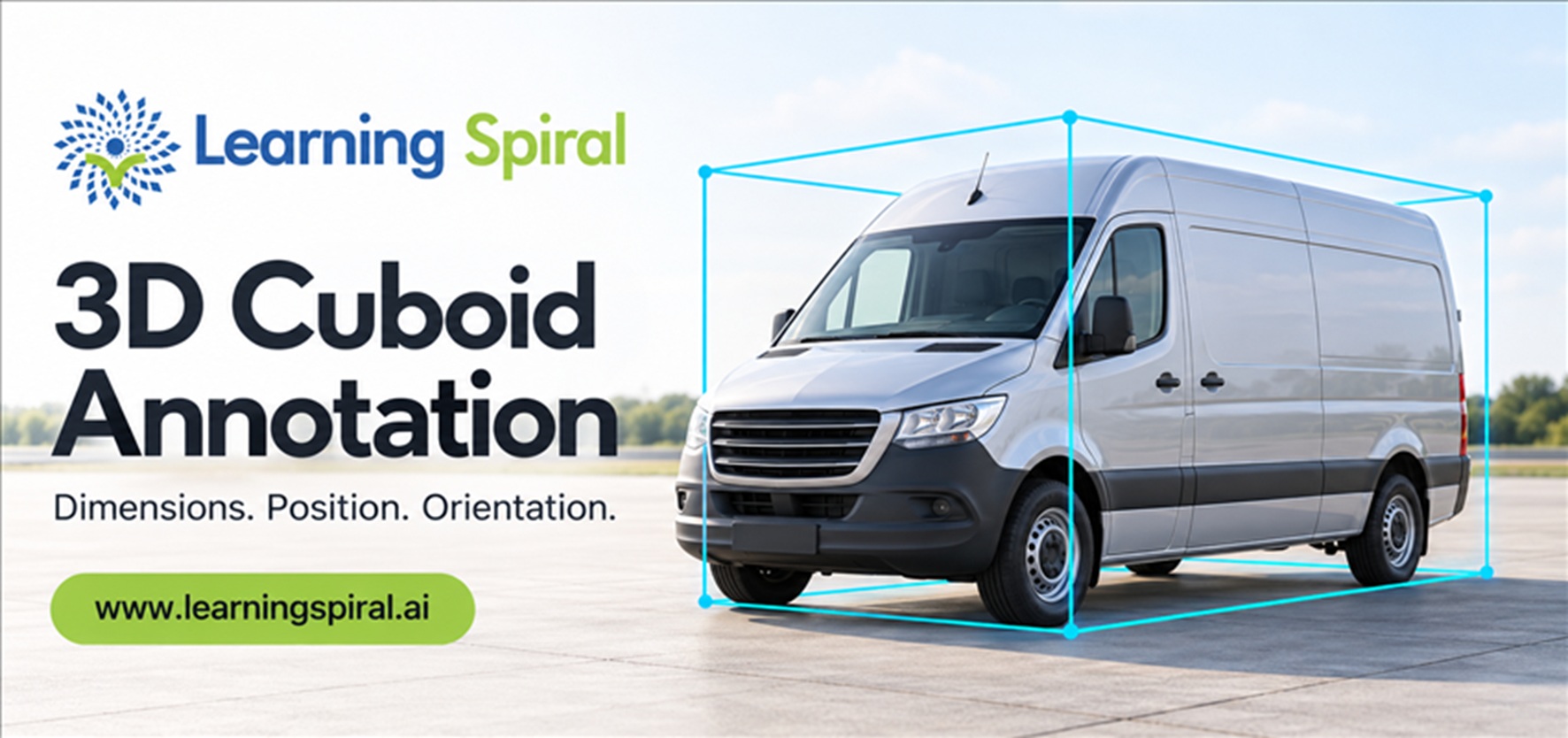
3D Cuboid Annotation is a data labeling technique that uses three-dimensional bounding boxes to identify objects and represent their physical dimensions, spatial location, and orientation.
Unlike a conventional 2D bounding box, which identifies an object within an image using a flat rectangle, a 3D cuboid represents the object across three dimensions.
A cuboid typically captures an object’s length, width, height, position, and heading. It may also include object class, visibility, tracking identity, and other attributes, depending on the dataset requirements.
This is especially valuable when working with a point cloud, a collection of spatial data points that represents the surfaces and structures of real-world environments.
For example, consider a warehouse robot identifying a pallet. A standard image may allow the robot to detect the pallet, but 3D annotation provides richer information about its location, size, and orientation. Such information can help train models used for navigation, object localization, and robotic manipulation.
Through our 3D point cloud annotation services, Learning Spiral AI supports the conversion of complex spatial data into structured training datasets for autonomous vehicles, robotics, and related perception applications.
The Three Essential Elements of 3D Cuboid Annotation
The value of cuboid annotation lies in its ability to describe an object geometrically rather than simply identify it visually.
Three measurements are particularly important: dimensions, position, and orientation.
1. Object Dimensions: Understanding Length, Width, and Height
Dimensions define the physical extent of an object in three-dimensional space.
A 3D cuboid generally records:
Length: The object’s extent along its designated longitudinal axis.
Width: The measurement across its lateral axis.
Height: Its vertical extent.
Consider a self-driving vehicle approaching a parked truck. Understanding that the object is a truck is useful, but understanding its physical dimensions provides additional information about the space it occupies.
Annotators fit a cuboid to the object’s observable geometry while following the project’s labeling rules for partially visible or obstructed boundaries.
A common technical challenge is determining the true physical extent of an object when only part of it is visible. Sparse sensor measurements, reflective surfaces, or nearby obstacles can complicate this task.
Learning Spiral AI supports object-level annotation workflows designed around project-specific class definitions, dimension rules, and consistency requirements.
2. Object Position: Identifying Where an Object Exists
Position refers to an object’s location within a defined three-dimensional coordinate system.
For many 3D object-detection datasets, location is represented using coordinates such as X, Y, and Z.
These coordinates describe a specified reference point of the object, commonly the cuboid center, although conventions differ between datasets.
For instance, an autonomous delivery robot may need to distinguish a package positioned directly ahead from another package placed on a higher shelf.
Correct spatial coordinates help training datasets represent these differences.
However, annotators must first understand the project’s coordinate frame. Sensor, vehicle, camera, and world-coordinate systems may each use different origins and axis directions.
Accurate labeling requires consistent coordinate interpretation rather than simply placing a box where an object appears to be.
3. Object Orientation: Understanding Which Direction an Object Faces
Orientation describes an object’s rotational alignment in space.
In many vehicle-oriented datasets, the primary orientation attribute is yaw, representing rotation around the designated vertical axis.
Other applications may also require pitch and roll, particularly when labeling objects operating on slopes, uneven terrain, or within complex robotic environments.
Imagine two vehicles positioned close together. They may have similar dimensions and nearby coordinates, but one is facing north while the other is turning east.
Without orientation labels, an AI model receives an incomplete description of their spatial configurations.
Correct orientation can support downstream tasks such as trajectory prediction, object tracking, and motion-aware perception.
The combined use of dimensions, position, and orientation makes 3D cuboid annotation a valuable technique for teaching models to interpret physical environments.
How Does 3D Cuboid Annotation Work?
A successful annotation project requires more than drawing boxes around detected objects.
It involves a structured workflow that brings together spatial data, labeling instructions, object classification, and quality validation.
Step 1: Define the Annotation Requirements
Before annotation begins, the project team establishes the classes of objects that need to be identified.
For an autonomous mobility dataset, these may include cars, buses, trucks, pedestrians, cyclists, barriers, and roadside infrastructure.
The instructions must also define minimum object visibility, handling of occlusion, coordinate conventions, annotation attributes, and the required output format.
These decisions establish a consistent foundation for the entire Dataset for Machine Learning.
Step 2: Prepare and Inspect Spatial Data
The next stage involves loading and examining data captured through sensors such as LiDAR, which measures distances using laser light.
LiDAR sensors generate spatial measurements that can be processed into point clouds showing roads, buildings, vehicles, equipment, and other objects.
Annotators examine this information from different viewpoints to understand object boundaries and scene geometry.
When camera images or additional sensor streams are available, calibration and synchronization information can help establish a more complete understanding of the scene.
Our Lidar Annotation workflows support the labeling of complex point cloud data for spatial perception, object detection, and related AI applications.
Step 3: Fit the 3D Cuboid Around Each Object
After identifying the target object, the annotator creates a three-dimensional box aligned with its estimated physical extent.
The cuboid is adjusted to represent the object’s geometry as closely as possible under the project’s annotation policy.
A useful way to understand this is through the concept of a bounding volume, which represents an object using a simpler geometric region.
For 3D cuboid annotation, the box should follow the object’s orientation and avoid including unnecessary surrounding space.
Careful attention is required when objects are unusually shaped, closely packed, partially hidden, or represented by only a few sensor points.
Step 4: Assign Object Classes and Attributes
Once the cuboid geometry has been established, annotators assign relevant object categories and attributes.
For instance, a labeled object may be classified as a passenger car, while additional fields capture visibility, truncation, or movement-related information if required.
For sequential datasets, object IDs may also be maintained across frames to support tracking and temporal consistency.
This combination of classification and spatial information helps create more useful AI training data than geometric boxes alone.
Step 5: Validate and Export the Labels
The final stage involves reviewing the completed annotations for accuracy and consistency.
Quality checks may examine whether cuboids are properly aligned with objects, whether dimensions are plausible, and whether the correct object classes have been assigned.
Where appropriate, teams can measure geometric agreement using metrics such as 3D Intersection over Union (IoU), alongside class-label and tracking-consistency checks.
After validation, annotations are exported in the schema required by the customer’s machine learning pipeline.
2D Bounding Box Annotation vs. 3D Cuboid Annotation
Both techniques are useful in computer vision, but they serve different purposes.
2D Bounding Box Annotation identifies an object within a flat image using rectangular coordinates. It is appropriate for many image-based object detection applications where depth is not the primary requirement.
3D cuboid annotation adds spatial information, including object depth, size, three-dimensional location, and rotational orientation.
For example, a traffic-monitoring application may use 2D image annotation to count vehicles passing through an intersection.
An autonomous driving perception system may additionally need 3D labels to learn where vehicles are positioned relative to its sensor frame and how they are oriented.
In practice, 2D and 3D techniques are often complementary. Multimodal AI models can benefit from both camera annotations and LiDAR-based geometric information.
The best method depends on the model’s intended task, the available sensors, and the precision required.
Common Challenges in 3D Cuboid Annotation
Although cuboid labeling appears straightforward conceptually, real-world spatial datasets introduce several challenges.
Sparse and Noisy Point Clouds
Objects farther from a sensor may be represented by relatively few points, making dimensions and boundaries difficult to estimate.
Annotations should follow consistent rules for low-density objects rather than relying on arbitrary guesses.
Occlusion and Truncation
An object may be partially hidden behind another vehicle, a building, or industrial equipment.
Cuboid fitting becomes more challenging when the annotator must estimate an object’s complete dimensions from incomplete observations.
Clear guidelines are essential for determining when to infer an extent, apply a visibility attribute, or mark an object as uncertain.
Incorrect Orientation
A box may fit an object’s dimensions but face the wrong direction.
This is particularly problematic for tasks involving vehicle heading, robotic movement, and trajectory analysis.
Inconsistent Coordinate Systems
Annotations can become unusable if different files or annotators apply incompatible coordinate frames, units, or dimension-order conventions.
A consistent schema should specify whether the box position represents its center or another reference point, which axis defines forward direction, and how rotation angles are interpreted.
Inconsistent Labels Across Frames
In a temporal annotation project, an object may change position while retaining the same physical identity.
Tracking labels should remain consistent across frames, and geometric changes should reflect actual movement rather than annotation instability.
Structured guidelines, calibrated tools, and human review help reduce these problems.
Where Is 3D Cuboid Annotation Used?
Autonomous Vehicles and Advanced Driver-Assistance Systems
Autonomous driving systems need to identify nearby vehicles, pedestrians, cyclists, and obstacles while interpreting their relative positions.
3D cuboid labels provide training examples containing spatial properties that support object detection and environmental perception.
Learning Spiral AI provides Image annotation for autonomous vehicles and related LiDAR labeling capabilities to support camera-based, point-cloud, and multimodal datasets.
These services are relevant to perception systems used in autonomous mobility and advanced driver-assistance development.
Robotics and Warehouse Automation
Robots operating in warehouses, factories, and distribution centers must identify objects and reason about the space around them.
Three-dimensional annotations can describe the geometry and placement of shelves, pallets, forklifts, packages, and equipment.
For robotics developers, this information can support training datasets for object localization, obstacle awareness, and spatial reasoning.
Our Image Annotation for Robotics capabilities complement 3D labeling by providing additional visual information for computer vision applications.
Industrial Automation and Logistics
Industrial environments frequently contain objects of different sizes, shapes, and orientations.
AI systems used in these settings may need to recognize equipment, locate materials, and understand their relative positions.
Cuboid annotation helps prepare spatial datasets for these perception-related applications.
For logistics projects, 3D labels can also provide geometric context for packages, cargo-handling equipment, and mobile robots.
Smart Cities, Mapping, and Infrastructure
Three-dimensional spatial datasets are valuable for understanding roads, buildings, roadside objects, and urban layouts.
Cuboid labeling can identify distinct objects within larger LiDAR scenes, while segmentation and boundary annotations describe more complex environmental structures.
This makes 3D labeling relevant to mapping, infrastructure analysis, and urban perception applications.
Agricultural and Outdoor Robotics
Agricultural robotics may use cameras, depth sensors, and LiDAR to understand farm environments.
Depending on the project, spatial annotations can identify equipment, navigation obstacles, and other objects that require three-dimensional localization.
Outdoor environments introduce additional challenges such as uneven terrain, vegetation, dust, and changing visibility.
Accurate, consistently labeled examples help developers build datasets representative of these operating conditions.
What Makes High-Quality 3D Cuboid Annotation Different?
The value of a dataset depends not only on the number of labels it contains but also on their reliability.
A technically useful 3D cuboid dataset should demonstrate consistent object boundaries, well-defined orientation rules, accurate class assignments, and compatible coordinate systems.
For example, two annotators labeling the same vehicle should be guided by the same policies for fitting its length, width, height, and heading.
Without those standards, even a large dataset can contain contradictory geometric examples.
Quality requirements should also reflect the intended application. A robotics system requiring precise object localization may need stricter tolerances than a dataset designed for general scene understanding.
A robust review process can combine manual inspection with automated checks for invalid dimensions, empty boxes, implausible geometry, missing attributes, and temporal inconsistencies.
Most importantly, difficult cases should have a documented resolution procedure so that reviewers and annotators can apply consistent decisions.
How Learning Spiral AI Supports 3D Cuboid Annotation Projects
At Learning Spiral AI, we understand that spatial AI development requires training data that reflects the complexity of real-world environments.
As a Data Annotation Company and Data Labeling Company, we provide specialized data labeling & annotation services to organizations developing computer vision, autonomous systems, robotics, and other AI applications.
Our approach emphasizes the following capabilities.
Project-Specific Annotation Guidelines
Each project begins with an understanding of its object classes, labeling objectives, data characteristics, and required annotation format.
We support customized instructions for cuboid placement, object classification, orientation, occlusion handling, and related attributes.
This helps create consistent labeling expectations across annotation teams.
Specialized 3D and LiDAR Labeling Support
Our annotation capabilities include 3D cuboids, point cloud labeling, segmentation, object detection, and tracking.
These services help transform complex sensor information into structured datasets suitable for machine learning development.
By aligning annotation workflows with project requirements, we support a range of AI Data Solutions for spatial perception applications.
Human-Led Quality Validation
Machine-assisted labeling can improve productivity, but complex spatial scenes still require careful human judgment.
Our approach incorporates Human in the Loop (HITL) principles to support annotation review, ambiguity resolution, and consistent application of labeling guidelines.
This is particularly valuable for overlapping objects, sparse point clouds, and difficult orientation cases.
Scalable Data Annotation Projects
Different AI development teams require different annotation volumes, timelines, and review processes.
Learning Spiral AI offers flexible data annotation services designed to support both pilot work and larger annotation projects.
Our trained teams can help organizations manage complex labeling requirements while maintaining structured workflows and quality-focused review.
AI Training Data Services Beyond 3D
Spatial AI may require more than a single type of annotation.
Depending on the application, camera-based image labeling, Video Annotation, object tracking, segmentation, and LiDAR datasets may need to work together.
Learning Spiral AI supports these complementary annotation capabilities, enabling clients to coordinate related data labeling requirements through a broader service offering.
For organizations comparing Computer Vision Companies in India or Data Labeling Companies in India, the important consideration is finding a partner that understands the specific data format, annotation schema, quality requirements, and intended AI application.
The Future of 3D Cuboid Annotation in Spatial AI
As Physical AI, autonomous robotics, and intelligent mobility technologies develop, the demand for meaningful spatial training data is likely to grow.
AI systems increasingly need to understand not just the identity of an object, but also its geometry, movement, and relationship to other objects.
Three-dimensional annotations provide structured training examples for many of these tasks.
At the same time, annotation workflows are evolving through model-assisted pre-labeling, multi-sensor integration, quality automation, and increasingly specialized review processes.
Human expertise remains important for validating uncertain labels, interpreting challenging scenes, and maintaining consistency across complex datasets.
The most useful AI training data will come from processes that combine appropriate technology with clear labeling guidelines and dependable human oversight.
Frequently Asked Questions About 3D Cuboid Annotation
What is the purpose of 3D cuboid annotation?
3D cuboid annotation represents objects using their dimensions, spatial position, and orientation. It provides labeled training data for AI models that need to detect and localize objects in three-dimensional environments.
How many values define a typical 3D cuboid?
Many road-scene annotation formats use seven geometric parameters: three for location, three for dimensions, and one for yaw orientation. Other formats may additionally represent pitch, roll, or other attributes.
What is the difference between 3D cuboid annotation and 3D point cloud annotation?
3D cuboid annotation is a specific method for placing bounding boxes around objects. 3D point cloud annotation is a broader category that can include cuboids, semantic segmentation, instance segmentation, polylines, and object tracking.
Why is human review important in LiDAR annotation?
LiDAR scenes may contain sparse points, occluded objects, sensor noise, and ambiguous boundaries. Human reviewers can help check whether annotations follow the project’s geometric and classification rules.
Which industries benefit from 3D cuboid annotation?
Autonomous vehicles, robotics, logistics, industrial automation, mapping, smart infrastructure, and certain agricultural robotics applications can benefit from spatially labeled training datasets.
Can Learning Spiral AI support large 3D annotation projects?
Learning Spiral AI offers scalable data labeling and 3D point cloud annotation services, with workflows tailored to project requirements. Teams can discuss dataset volumes, class taxonomies, quality expectations, and timelines to determine an appropriate delivery approach.
Conclusion: Better Spatial Understanding Starts With Better Training Data
3D cuboid annotation plays an important role in preparing AI systems to understand objects in real-world environments.
By representing object dimensions, position, and orientation, it transforms raw spatial observations into structured information that can support object detection, localization, and scene understanding.
However, accurate labeling requires more than placing three-dimensional boxes. Clear annotation guidelines, consistent coordinate systems, careful orientation labeling, and dependable quality validation are equally important.
At Learning Spiral AI, we help organizations transform complex visual and spatial data into structured, model-ready datasets through expert data annotation services.
Whether your project involves autonomous vehicles, robotics, LiDAR, or advanced computer vision, our team can help you plan a labeling workflow aligned with your AI development requirements.
