Drones are revolutionizing how we see our forests. Flying high above dense canopies, they capture detailed drone imagery that reveals what’s really happening below—tree health, illegal logging, or biodiversity hotspots. But raw aerial photos aren’t enough. Enter drone imagery annotation, the key step that turns those images into actionable maps for conservationists and forest managers. By labeling features like trees, rivers, and paths, image annotation services make it possible to create precise forest mapping—and companies like Learning Spiral AI are leading the charge in India.
Why Forests Need This Tech Boost
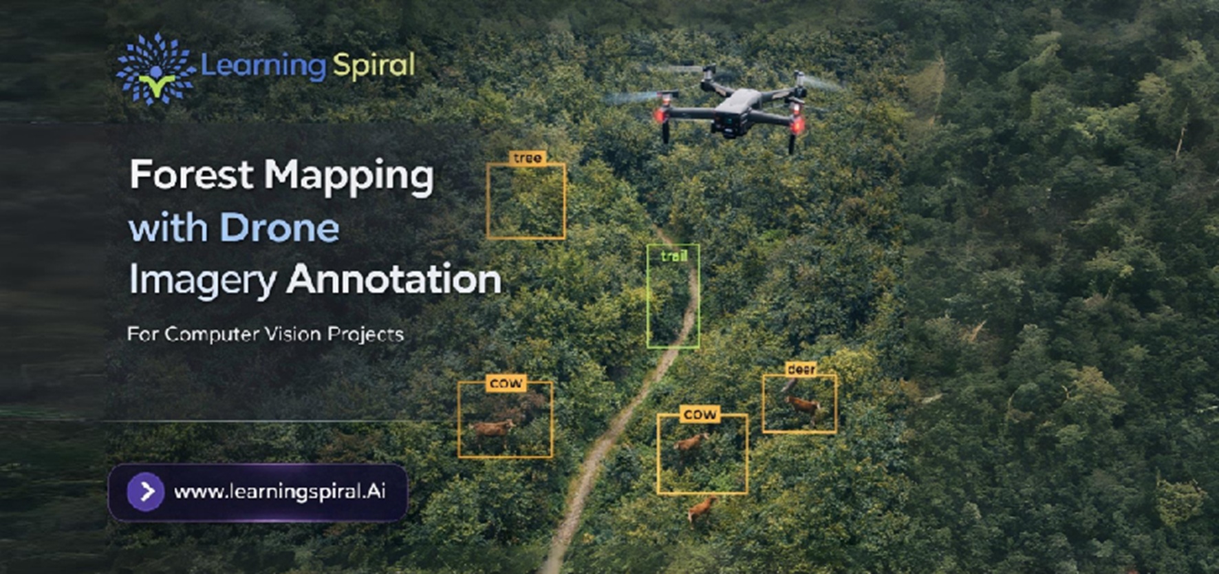
Traditional forest surveys mean trudging through thick underbrush with GPS devices. It’s slow, risky, and misses a lot. Drone imagery annotation changes that. Drones equipped with cameras or LiDAR scan vast areas quickly, producing high-res images or 3D point clouds. Then, skilled annotators use tools for bounding box annotation, polygon labeling, or 3D point cloud annotation to mark every detail. Suddenly, you have a digital forest map showing canopy density, species distribution, and even fire risks.
This isn’t just about pretty maps. Accurate forest mapping with drone imagery annotation helps track deforestation in real-time, plan reforestation, and monitor wildlife habitats. In India, where forests cover 24% of land but face massive pressure, this tech is a game-changer for sustainable management.
How the Annotation Magic Happens
Picture this: A drone flight over a rainforest yields thousands of images. A data annotation company like Learning Spiral AI steps in with expert teams trained in image annotation for aerial imagery. They draw precise boundaries around trees (semantic segmentation), tag soil erosion spots, or classify vegetation types. For LiDAR data, LiDAR annotation creates 3D models that reveal ground cover hidden by leaves.
Learning Spiral AI, a top data labeling company and computer vision company in India, excels here. Their data labeling & annotation services handle everything from image labeling to video annotation, ensuring pixel-perfect accuracy. Whether it’s image annotation for agriculture (spotting crop-like invasives in forests) or environmental projects, their scalable annotation projects deliver fast, reliable results. No more guesswork—just data-driven insights.
Real-World Wins and Future Horizons
Take Amazon rainforest monitoring: Annotated drone images helped detect 20% more illegal logging than satellite data alone. Closer home, Indian agencies use this for tiger reserves, mapping trails without disturbing animals. Image annotation companies in India like Learning Spiral AI make it affordable and quick, supporting data annotation projects that blend human precision with AI efficiency.
Looking ahead, integrating AI data solutions will automate more—think auto-detecting disease in tree clusters. But human oversight via image annotation remains crucial for quality. Challenges like varying light or dense fog? Expert data annotation services from data labeling companies in India tackle them head-on.
Partner with Experts for Greener Tomorrows
Forest mapping with drone imagery annotation isn’t sci-fi—it’s happening now. As a premier image annotation company, Learning Spiral AI offers tailored data annotation for environmental good. From medical data annotation to image annotation for autonomous vehicles, their versatile services power innovation. Ready to map your forests? Their image annotation services ensure every pixel counts toward conservation