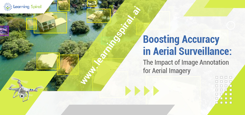
Aerial surveillance has revolutionized the way industries like agriculture, defense, urban planning, and environmental monitoring collect data. The use of drones and satellites to capture high-resolution images from the sky offers unparalleled insight, but these images need to be accurately annotated for effective analysis. Image annotation for aerial imagery is the key to unlocking the true potential of this data. This is where expert data labeling and annotation services, such as those offered by Learning Spiral AI, come into play. 
Aerial imagery, while rich in valuable information, often requires precision to interpret effectively. Raw images may contain complex visual data that needs to be classified, tagged, or segmented to be useful for analysis. Through image annotation, every object, from buildings and roads to natural features like forests and rivers, is identified and labeled. This process helps AI systems train and learn to recognize patterns, contributing to more accurate decision-making.
The impact of image annotation in aerial surveillance is profound. For example, in agriculture, annotated aerial images can help monitor crop health, assess irrigation needs, and predict yields. In defense and security, image annotation aids in identifying threats and monitoring borders, ensuring national security. Urban planners can use annotated images to track development projects, while environmental scientists can detect changes in landscapes, deforestation, or water bodies.
At Learning Spiral AI, we provide cutting-edge data annotation services tailored for aerial imagery. Our expert team uses advanced techniques to ensure every detail in aerial images is captured accurately. With our precise annotation, industries can rely on the annotated data to make informed decisions and drive innovations.
Moreover, our AI-powered solutions streamline the annotation process, reducing time and cost while maintaining high accuracy levels. With a focus on quality and efficiency, Learning Spiral AI is committed to supporting industries in leveraging aerial surveillance data to its fullest potential.
In conclusion, image annotation for aerial imagery is a game-changer in surveillance. By partnering with a trusted data annotation company like Learning Spiral AI, organizations can significantly boost the accuracy of their aerial data analysis, leading to smarter, data-driven decisions.